Spotlight Exhibit: The ROK Signage – Rock Butte Siding
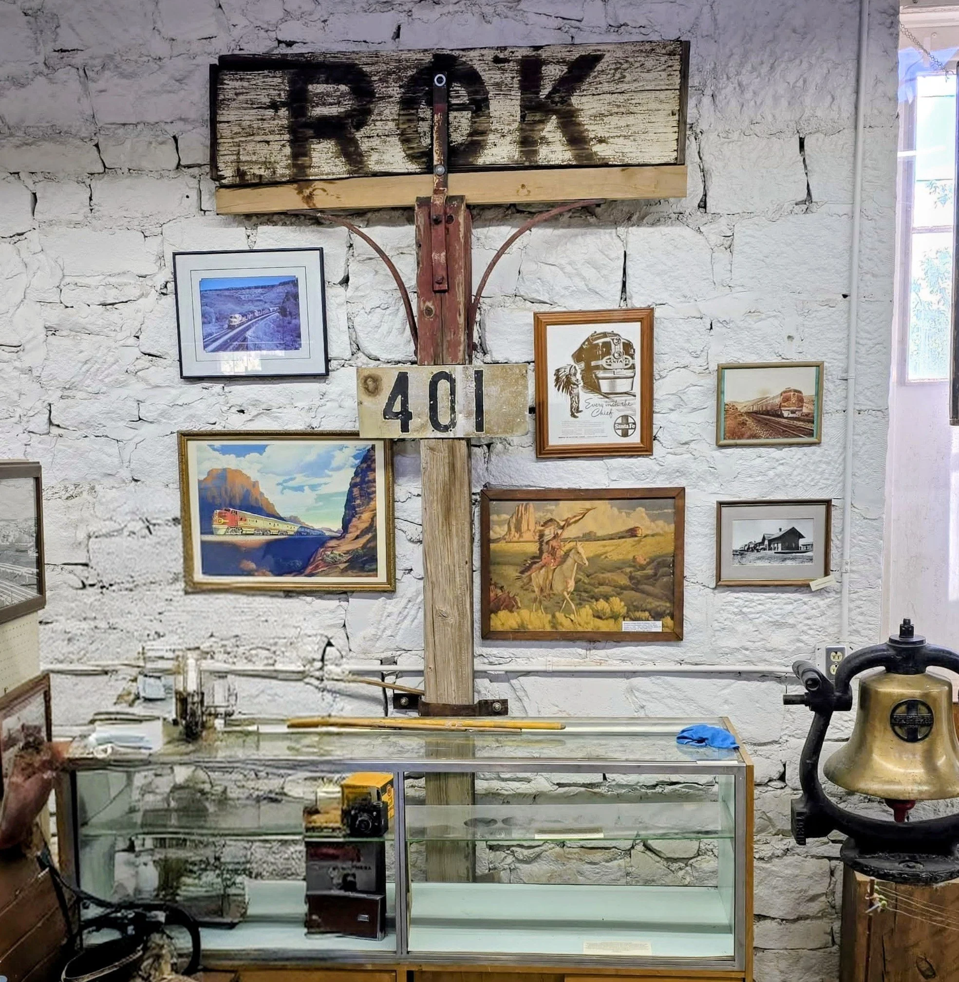
The Ash Fork Historical Museum is proud to display the original ROK signage, donated by George Garcia Jr., a tangible reminder of a long-forgotten railroad stop on the Santa Fe main line.
What Was Rock Butte?
Rock Butte was not just a local landmark—it was an official railroad siding on the Atchison, Topeka & Santa Fe (ATSF) Railway. It appears in the 1897 Santa Fe timetable, listed in sequence between Ash Fork → Rock Butte → Del Rio on the line heading toward Prescott. This meant Rock Butte was a recognized operational point—whether for passing trains, taking water, or as a flag stop for passengers.
Located about 16 miles west of Ash Fork near Little Hell Canyon, Rock Butte sat at an elevation of about 4,935 feet. Period sources list it specifically as “Rock Butte (siding),” and its telegraphic abbreviation became simply ROK.
Why the Name “Rock Butte”?
The siding was named for a prominent rock formation in the area. In the early years of railway planning, engineers debated whether the Prescott line should cross Hell Canyon directly or swing westward across the rugged terrain near Rock Butte. The western alignment proved more practical, and this decision gave the line its nickname—“The Scenic Railway of Arizona.”
Thus, the siding’s name reflects both the surrounding topography and the key role the landscape played in determining the route of the railroad.
Historical Significance
Rock Butte and its surrounding territory were recognized as part of the Limestone Canyon District, a section of the ATSF line that is listed in the National Register of Historic Places. While Cedar Glade, Puntenney, and Hell Canyon are often better known, Rock Butte was a distinct siding, serving as an operational waypoint along one of Arizona’s most important transportation corridor.
Why the ROK Sign Matters
This original ROK siding sign, now preserved at the museum, gives visitors a direct connection to the railroad era that shaped Ash Fork’s history. For railroaders, this sign once marked a precise point on the mainline. For today’s visitors, it marks a piece of the town’s heritage—one that reminds us how geography, engineering, and transportation all came together in shaping northern Arizona.
👉 Did You Know?
Rock Butte was on the mainline west of Ash Fork, not on the Paulden–Ash Fork stretch of the Peavine branch.
The siding’s exact location can still be studied today using old ATSF maps and the 1897 timetable.
“ROK” is one of the many abbreviated names railroaders relied upon for efficiency in dispatching and telegraph operations.